 |
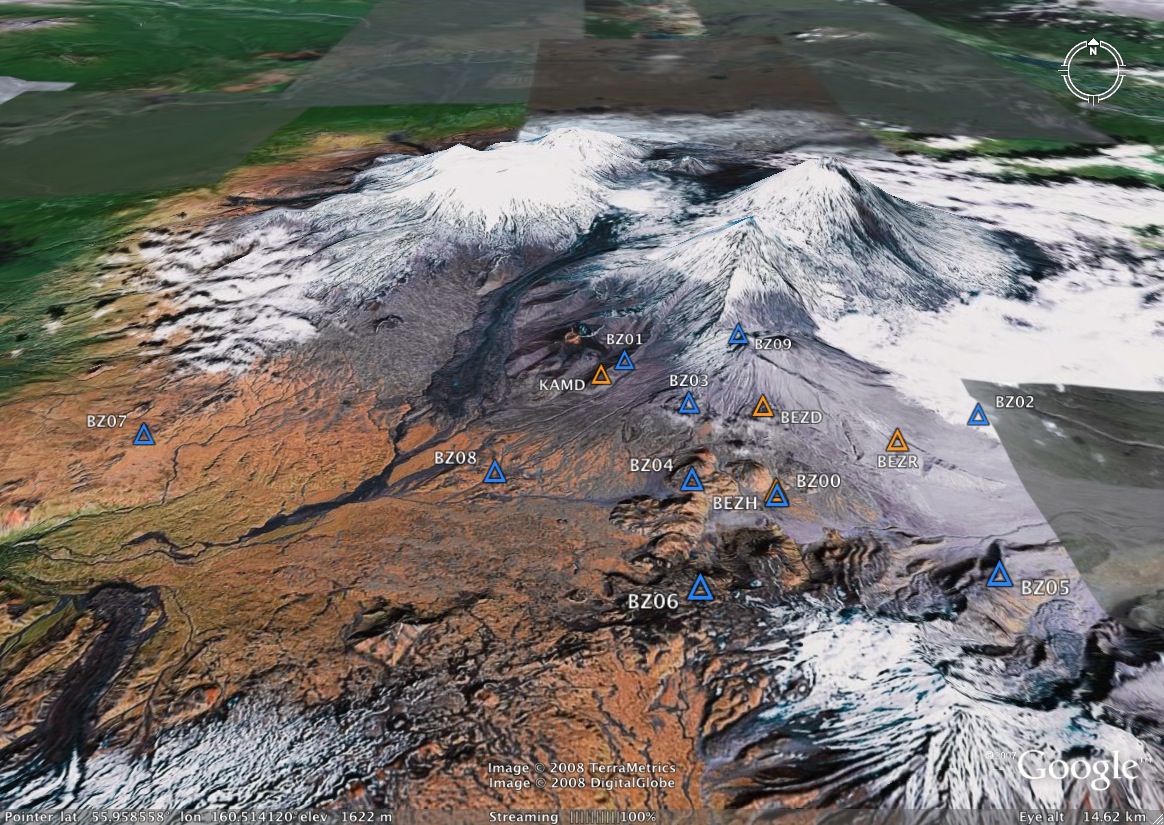
Locations of GPS Sites This Google Earth map shows the locations of the 4 campaign (orange) and 10 continuous (blue) GPS sites, as of January 2008. |
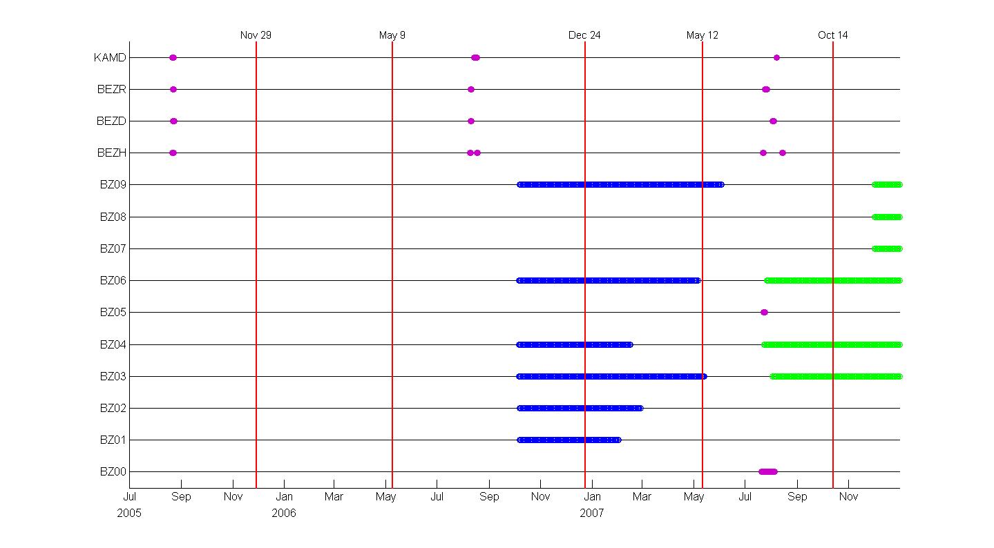
| GPS TimetableBecause of differences in installation dates, weather, and technical difficulties, the continuous stations have run during different time intervals. This figure shows the time intervals over which each station was operating, as well asthe dates of campaign surveys and Bezyimianny eruptions. |
| The figure was produced using Matlab codes (m-files) by Gwyneth Hughes, available below, as is an Excel version of the GPS timetable. Files for generating figure | |
| Excel version of Timetable |
Partnership for Volcanological Research and Education
