
Background
The relationship between vertical motion of the land and sea level rise needs to be better understood in order to provide useful information to coastal decision makers on a variety of issues such as land use and community planning. In Kachemak Bay, Alaska, near the town of Homer, coastal uplift due to tectonic and postseismic deformation (following the great earthquake in 1964) and rapid ice-mass loss from immense ice fields has influenced coastal habitat and affected coastal communities in many ways that have largely gone undocumented. This project aims to document more precisely the relative sea level changes and impacts on coastal habitat.Local communities are interested in the implications for predicted sea level change, patterns of coastal erosion, infrastructure construction and protection, planning, zoning, and public safety issues. Changes in the local community ecology and potential impacts to food resources (salmon and their associated habitats and near-shore species of invertebrates and plants) are also important.
Goals
The primary goal of this project is to provide accurate vertical positioning information for coastal managers to support informed decisions on land use planning and public safety and improve predictions of future coastal elevation, sea level rise, and habitat changes.
Objectives
The null hypothesis for this study is based on the pre-existing estimates of land surface uplift and relative sea level in the area and the estimated rate of global sea level rise: the uplift rate of the land in the Kachemak Bay region is uniform and equal to the regional average of GPS measurements, and uplift is faster than global sea level rise, with a net effect of producing a long-term decline in relative sea level.The impacts of sea level change on coastal ecology and on the local community have will be explored as part of our project. The data collected through this project will allow us to test several additional hypotheses that relate to the causes and effects of sea level changes in Kachemak Bay. These hypotheses will be tested against the null hypothesis and used to develop a synthesis model that explains the causes of sea level change in the area and its effects on coastal ecosystems, while allowing more accurate predictions of future changes.
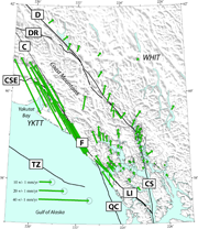
- Determine if bedrock uplift rates in the area are uniform, or if they vary along the length of the Bay.
- To determine if areas surrounding the coastline of Kachemak Bay that are largely comprised of unconsolidated glacial till are experiencing similar uplift projections to sites located on bedrock, and to monitor elevation and changes in vegetation in salt marshes as an indicator of the balance between sea level rise and coastal rebound.
- To improve earlier estimates of coastal uplift rates, which were generated for the greater Kenai Peninsula; refine models to better predict uplift rates in areas between measurement sites; refine estimates of regional sea level rise; and assess the impacts of coastal change for all coastal habitats of Kachemak Bay.
Hypotheses to be tested
- Hypothesis 1: Bedrock uplift rate is non-uniform, with slower uplift rates at the head of the Bay.
- Hypothesis 2: Soft sediments subside and compact, with the surface moving downwards relative to bedrock, and these locations experience less net uplift than bedrock sites.
- Hypothesis 3: Increasing sedimentation and relative sea level fall are shifting salt marsh habitats seaward.
- Hypothesis 4: Observed uplift rates can be explained by a model that combines isostatic adjustment due to melting of glaciers and icefields, steady tectonic deformation, and post-seismic deformation following the 1964 earthquake. Regional sea level rise can be explained by a combination of global sea level rise and changes in the shape of the mean sea surface related to the deglaciation of southern Alaska. If hypothesis 2 is confirmed, then compaction and subsidence of sediments would need to be added to the model for non-bedrock sites.
Current uplift rates for the project sites in Kachemak Bay will be presented in the table below soon. As of May 2012, data spans remain a bit too short. Contact me for updated information.
|
ID |
Site |
Data Span |
Uplift Rate (mm/yr) |
Uplift Rate (inches per year) |
|
HDPW |
Homer Dept. of Public Works |
10/2010 - 05/2012 |
not enough data |
not enough data |
|
MCES |
McNeil Canyon Elem. School |
11/2011 - 05/2012 |
not enough data |
not enough data |
|
PBAY |
Peterson Bay |
05/2011 - 05/2012 |
not enough data |
not enough data |
|
SPIT |
Homer Spit |
11/2011 - 05/2012 |
not enough data |
not enough data |
|
VOZN |
Voznesenka |
11/2011 - 03/2012 |
not enough data |
not enough data |
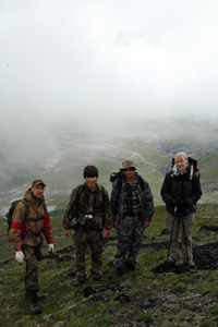
This project is supported by NOAA's National Estuarine Research Reserve program. The Kachemak Bay Research Reserve (KBRR), part of the State of Alaska Department of Fish and Game, is the lead agency, PI Angela Doroff.
Dr. Jeffrey T. Freymueller
Professor of Geophysics
Geophysical Institute
University of Alaska, Fairbanks
Fairbanks, AK 99775-7320